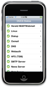
As of this afternoon, the University of Oxford is a member of the iPhone Developer programme which can help facilitate the production and distribution of applications to potential developers within the organisation (and to the app store). If you are a member of the University and would like to submit an app to the app store or require provisioning to allow testing on your devices, please drop a line to erewhon at oucs.ox.ac.uk
National Rail App Released for the iPhone
March 24, 2009 A quick post to note that National Rail has released an application for the iPhone/iPod Touch which allows for comprehensive live train departure boards and journey planning. Head over to: http://nationalrail.co.uk/iphone/ for more information and a demo.
It’s probably the most comprehensive mobile transport application in the UK and is certainly a welcome replacement for the now missing Kizoom MyRail Lite which strangely disappeared from the Apple App Store some time ago.
The new OxPoints
March 20, 2009After spending lots of time looking into RDF and how we could use RDF as the data model for the new OxPoints system we finally decided to give it a try. One of the big problems we had with RDF was the difficulty of storing dimensional data as one of the key features of the new OxPoints system should be its ability to record the change of Oxford University over time. However, RDF does not really cope with change and we had to think about how to work around this. We presented a detailed description and two possible workarounds in previous posts:
Both solutions are somewhat similar as they try to add additional RDF statements to define the validity of other statements. Solution one was to use statement reification and to add temporal information on individual statements. The other way we saw was to use named graphs and use different graphs to group statements that talk about the same time span. In the end we decided to go with the second solution, as it seemed to be the cleaner and more efficient solution.
As the platform for the new system we chose Java with Jena as the underlying RDF triple store.
We have spend the last weeks developing the prototype and so far the results are promising. The minimal requirements for the new system were to do everything the old system does, which was basically to allow for point queries (ask for a specific unit, or for a specific type) and to transform the results into KML.
Besides KML the new system offers transformations into JSON and RDF for any kind of resultset produced by the system and it is able to handle the temporal aspect of the data. In fact the new system is much more powerful and not specific to OxPoints at all. It is an RDF to Java object mapper (comparable to object relational mapping systems) and we are currently working on documentation and we are hoping to make more information available soon.
A first demo we produced, built upon the new OxPoints, is a Greasemonkey script that adds links to the OLIS (Oxford Libraries Information System) result pages, to display where a particular library is, using Google maps. The demo is not yet publically available but we are working hard on publishing this and more demos soon.

Screenshot of library demo
Google’s Grand Central Set to Launch Soon
March 16, 2009 Although this might appear slightly irrelevant to the Erewhon project, Google’s new Voice service (known as ‘Grand Central’ in a previous life) is set to relaunch soon.
So what exactly does Google Voice do? It’s essentially a single phone number which can be linked instantly to all your possible numbers and messaging services. The average person changes their mobile phone number several times during the course of their life which is at great pain to their contacts and indeed adds costs with the reprinting of business cards etc. Google Voice gives you is the ability to change your mobile phone numbers as you please but allows you to keep one public number and forwards your calls accordingly.
Other features include being able to selectively direct known people to different numbers. Your business contacts could all be directed to your work phone number, wheras everyone else could be directed to your mobile. Text messaging can also be forwaded and Voicemails can be automatically transcribed to text and emailed to you. This is certainly a tool that could change how people use their telephone services in the future.
Apple iPhone Developer Day at Oxford
March 13, 2009
iPhone Demonstration Program
A quick post to say that OUCS is planning an iPhone developer ‘boot camp’ on Friday, 1st of May 2009 which will be open to University of Oxford staff and students. The lecture series will be run by Paul Burford from Apple World Wide Developer Relations and be hosted within Oxford University Computing Services.
The red nose day run begins!
March 13, 2009
To watch their progress head over to: http://tei.oucs.ox.ac.uk/runmap/
and to see their route: http://tinyurl.com/araj79
Erewhon is hiring a developer
March 9, 2009We’re looking for a new developer to join the project. The job is to work on
- support and development of the RDF-based geolocation database we have built to describe Oxford
- demonstration mobile phone apps for higher education
- creation of a mobile-friendly interface to the Sakai VLE
These will mostly involve Java programming, with perhaps Objective C as well for the iPhone, but there is plenty of opportunity to shape the project and generally present the aims of the Erewhon project. If you know higher education, like RDF, think mobile devices are fun, then this is your job.
If you’re interested, have a look at http://www.oucs.ox.ac.uk/jobs/erewhon.xml and send in your application.
Making Google Maps from a GPS track
March 5, 2009It can hardly have escaped most people’s attention that Google Maps is an incredibly useful tool. I just used it to plan my summer holidays, marking where we are staying, places to visit, routes to take and so on. I did this using the My Maps feature, available through a Google Account, which lets you annotate and edit a map. What may not be so obvious to new users is that you can save the map as KML by using the link URL. and adding “&output=kml” to the end.
More interestingly, you can import KML files into My Maps in Google Maps, which adds extra possibilities. I exploited this when I made a map of the running route for the Red Nose Day Run we are doing. You can see the result at http://maps.google.co.uk/maps/ms?ie=UTF8&hl=en&msa=0&msid=113734510941254986423.000462ba294a2a1373c9f&z=14. I created this by travelling the route wearing a GPS-enabled watch (the excellent Garmin Forerunner 305), and converting the resulting track record to KML (using a program called Ascent on my Macintosh).
All well and good, but the Forerunner had recorded a point every few metres, and that was too much for me to further edit by hand. I was able to get a much neater result by smoothing the KML using the “simplify” filter of the excellent gpsbabel (http://www.gpsbabel.org/) utility. This removed all points which did not make more than 10 metres of difference. Now I could upload the filtered map to Google Maps and refine the route by using it as a KML editor. Now I have to actually run the route – rest assured that we’ll be tracking what we actually do using a variety of GPS tools.
Of course there are a 1001 tools out there for editing KML, making map-based visualizations, plotting routes, and so on. I’m just talking about casual use here. But the extreme ease of performing tasks like this shows that there is no excuse for not getting into geolocating things in your life.
Erewhon staff raising money for Comic Relief
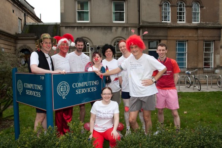
March 5, 2009March 13th is Red Nose Day in the UK, when people do silly things to raise money for the Comic Relief charity, which works to alleviate poverty around the world.
Not wanting to be left out, staff from Oxford University Computing Services (where Erewhon is based) are going to run around the city visiting every single one of the Oxford colleges. If you’ve ever been to Oxford, you’ll know this is no small job – we think it’ll be nearly 9 miles. Remember that most of us sit at keyboards all day, so we expect to suffer.
Are you willing to help us raise money, dear reader? If so, head off to http://erewhon.oucs.ox.ac.uk/rednose/ and look at the details.


 Posted by Tim Fernando